
Geospatial Services
GIS Analysis
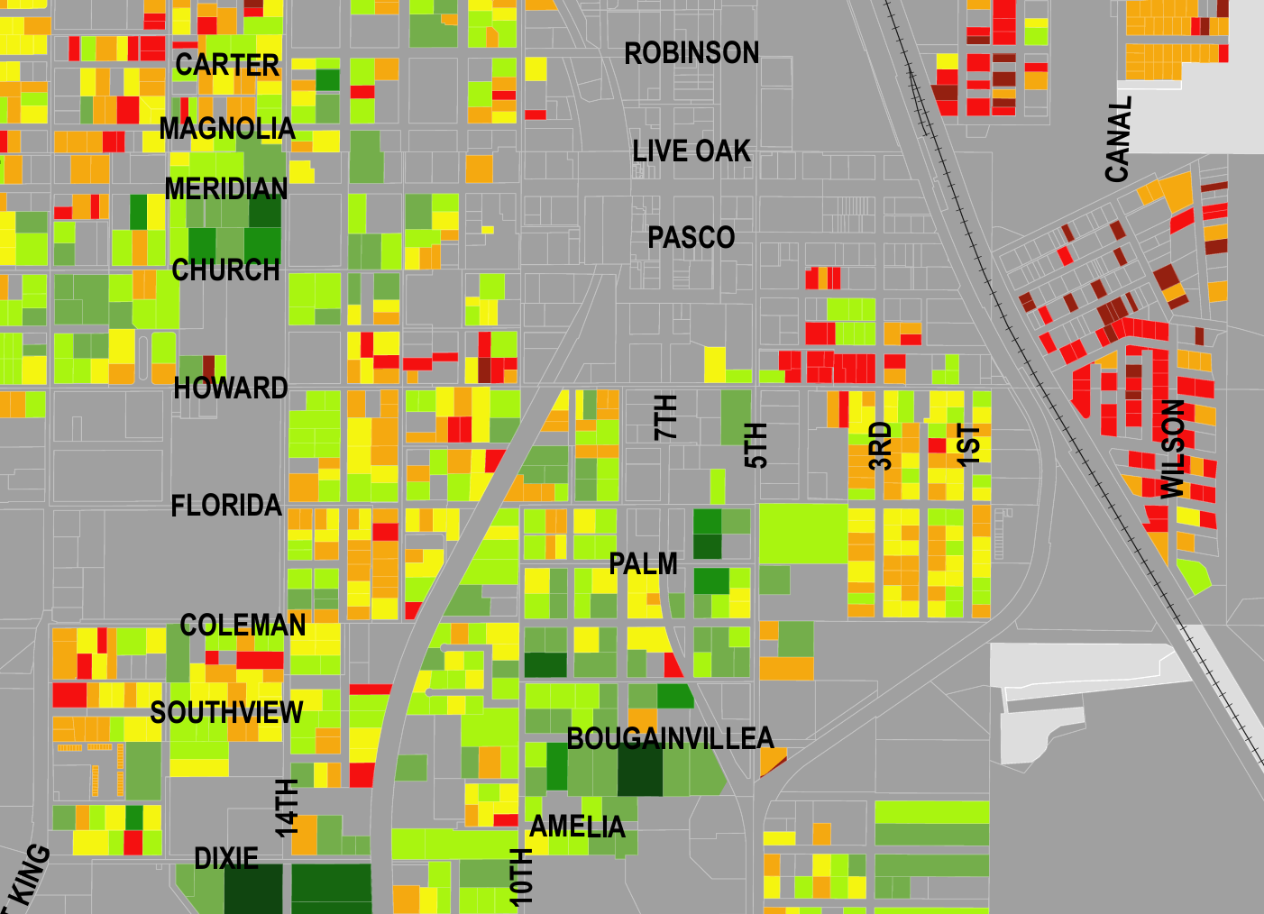
Craig Spatial provides rigorous spatial analysis built on real‑world datasets and a strong foundation in Geographic Information Science (GIS). The studio specializes in identifying patterns, relationships, and changes that help clients make informed decisions, whether the project involves land use, value, transportation, environmental factors, or neighborhood‑level insights. Resourceful data sourcing is a core strength, allowing Craig Spatial to locate high‑quality free datasets when clients don’t have their own.
Custom Cartographic Design
Craig Spatial produces tailored maps for reports, presentations, planning documents, and digital platforms. Each map is built with intentional color choices, clean typography, and a layout that fits the project’s purpose, whether that’s clarity for decision‑makers, visual impact for a presentation, or consistency with an existing brand. The studio’s work emphasizes expressive, bold‑color design, clean layering, and disciplined hierarchy, creating maps that communicate quickly and look intentional at every scale.
Interactive Historic Mapping
Craig Spatial develops custom static maps and interactive web projects that merge archival material with modern datasets to more effectively highlight the past. These projects often combine scanned maps, historic imagery, georeferenced layers, and narrative text to create a clear, engaging story about change over time. This service is optimal for municipalities, museums, local history groups, academic partners, and anyone who wants to bring historic information into a modern digital format.
Terrain and Elevation Modeling
Craig Spatial creates custom elevation profiles, terrain visualizations, and relief maps that reveal structure, slope, and form within the landscape. The studio’s approach emphasizes clarity, smooth gradients, and refined contour linework to highlight underlying geography while blending quantitative analysis with strong cartographic design. Ideal for golf courses, ski resorts, park trails, historic sites, and projects needing terrain-driven insight.
Web Mapping & StoryMaps
Interactive web maps, StoryMaps, and ArcGIS Online deployments that turn raw datasets into modern, accessible tools for cities, organizations, and the public. This service includes converting legacy shapefiles into hosted feature layers, building municipal‑grade web maps, and creating narrative StoryMaps that combine data, photographs, and place‑based storytelling. Craig Spatial delivers clean, reliable, easy‑to‑maintain web mapping systems that work on any device.
Work With Craig Spatial
Tell me about your project and I’ll follow up with the next steps.