Routing & Elevation
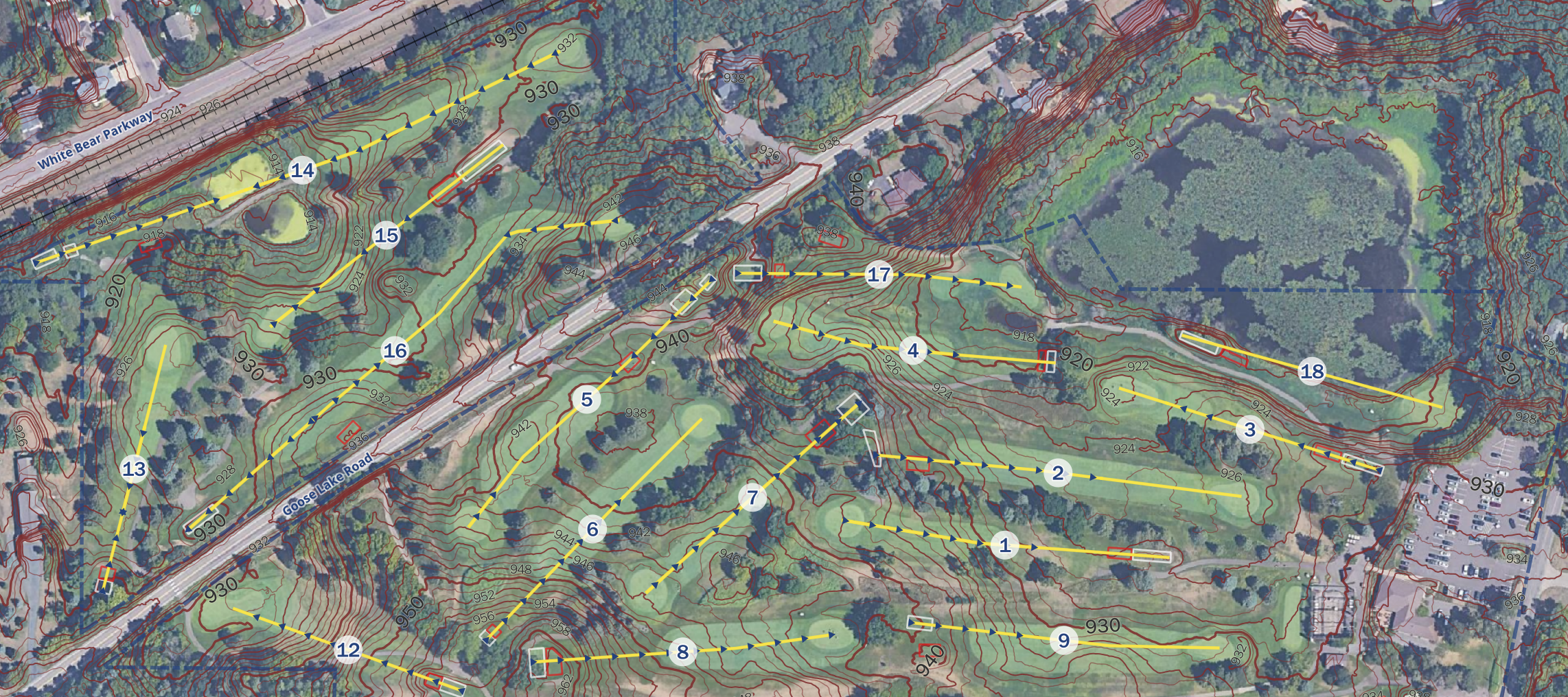
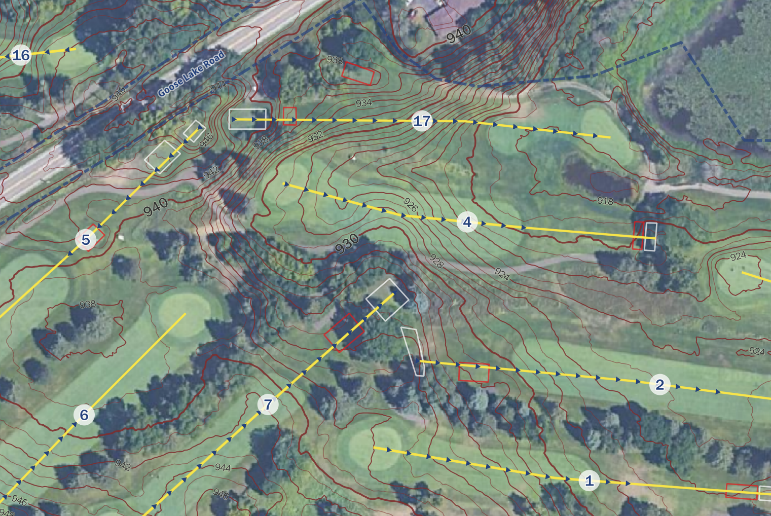
This Routing & Elevation map details Gem Lake Hills in White Bear Lake, Minnesota as a prototype. Craig Spatial downloaded Ramsey County parcel data, road centerlines, and MnTOPO LiDAR digital elevation model for terrain, then symbolized the contours with bold 10‑foot intervals, intermediate 5‑foot lines, and thinner 2‑foot lines. Craig hand‑drew the hole centerlines, tee boxes, and downhill/uphill indicators.
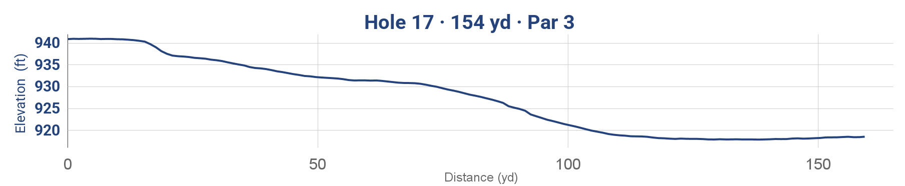
Craig exported the default elevation profiles from QGIS into Google Sheets for further customization, combining the elevation‑in‑feet profile with the hole atlas. Each layout rotates so the tee box sits at the bottom, the putting green at the top, and the scale bar in yards along the side to help the golfer read distance and slope instantly. A darker ovular gradient draws focus to the area of emphasis around each hole.
This workflow can be replicated for any golf course, disc golf layout, ski hill, or trailhead in the country, and reflects Craig’s passion for the outdoors, golf, and maps.
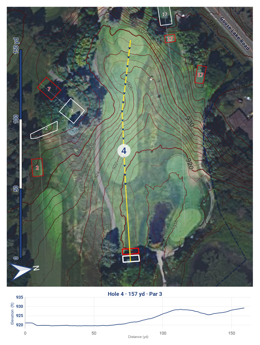
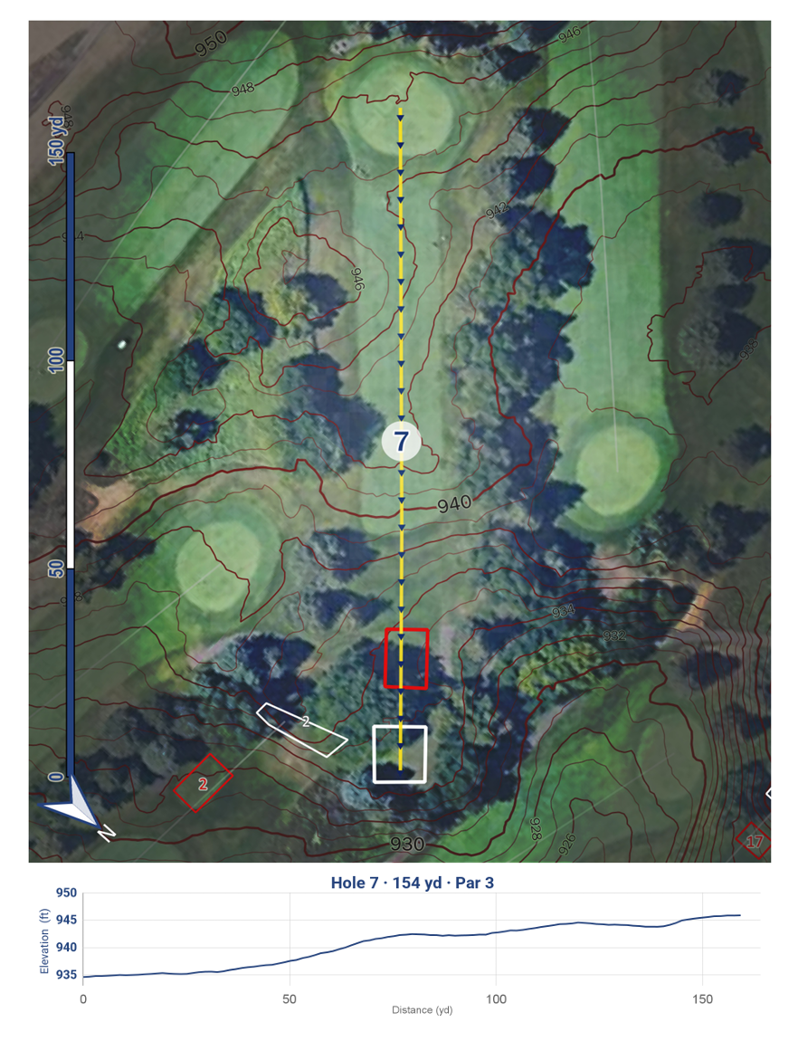
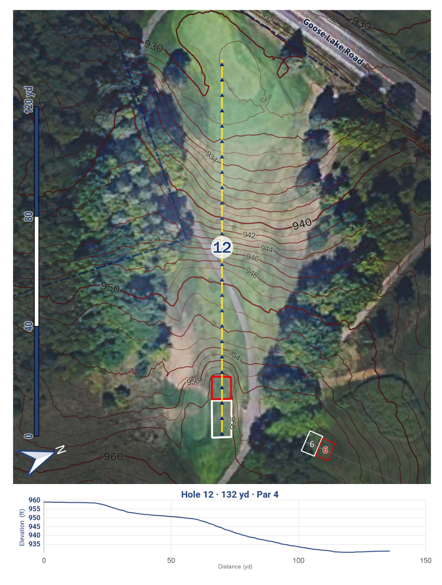
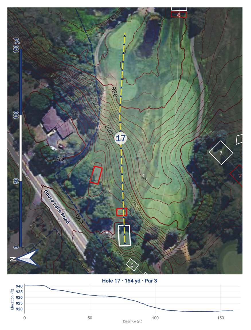
The blue matches the official colors of the golf course, and the contours on Holes 4, 7, 12 and 17 really demonstrate the elevation changes. The elevation profile at the bottom sits in a consistent centered position and uses a 5‑foot delta on the Y‑axis for clarity. Overall, this was a very fun project for Craig.