
Historic Maps
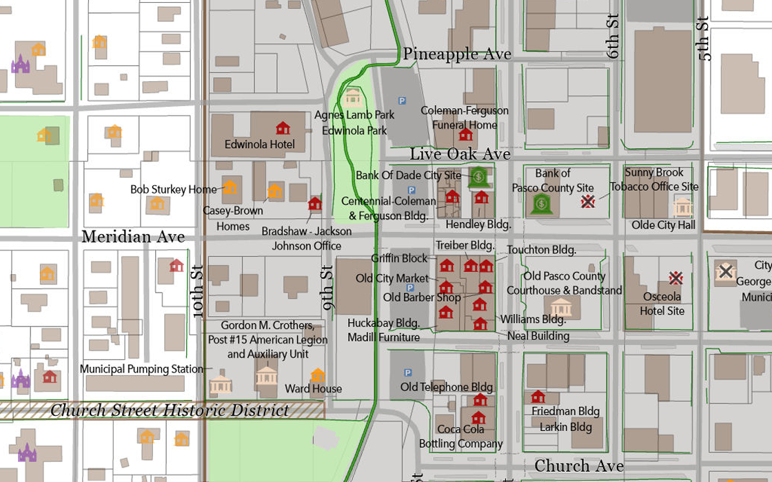
Craig Spatial combined the official historic register descriptions prepared by the Historic Preservation Advisory Board with modern GIS layers to create a clear, complete map of historic register of sites within Dade City in both print and digital formats.
The map uses current street names, building footprints, park boundaries, and parking lots sourced from earlier visitor‑map projects. Craig digitized more than 112 buildings and sites from the historic register and linked each one to its written description. This work led to an interactive web map and complete historic website the city uses to help visitors learn about each property. The site is available on the Historic Dade City page of the city’s website.
The final map blends historic information with modern cartography so residents, visitors, and researchers can explore and learn more about the structures of the historic register.
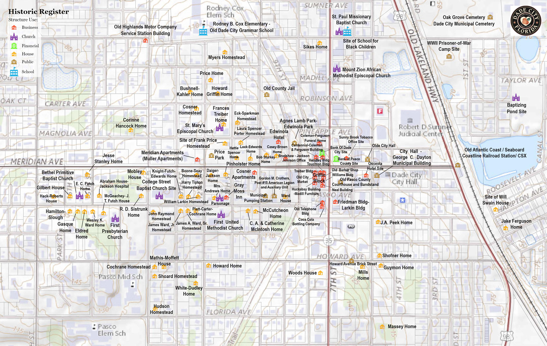
On the historic register maps, each site includes its address and a color‑coded symbol showing its type: red for commercial buildings, purple for churches, yellow for historic homes, green for financial institutions, and tan for government buildings. Demolished sites are marked with an X to preserve the record of structures that once stood.
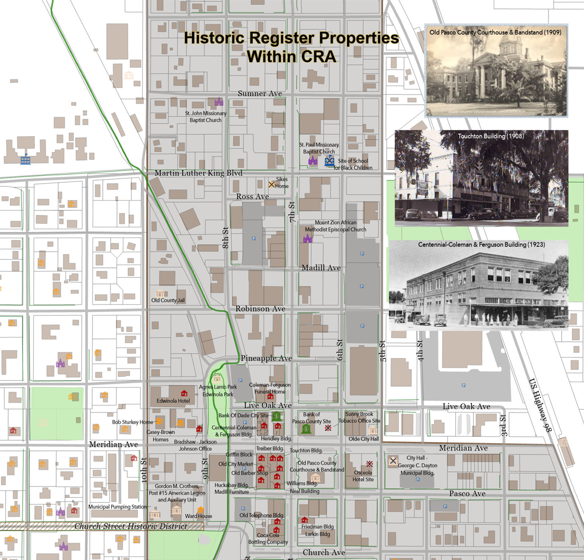
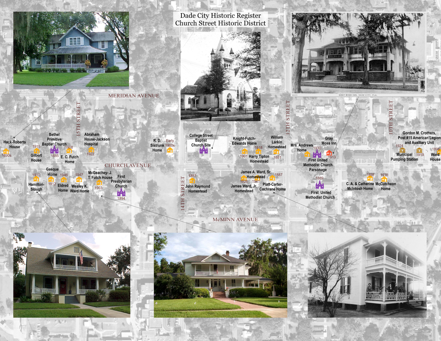
These two maps of historic structures within the Community Redevelopment Area and the Church Street Historic District use historic postcards and old photographs to annotate the buildings, bringing the historic register to life by showing the year each structure was built and labeling the name of every site directly on the map.
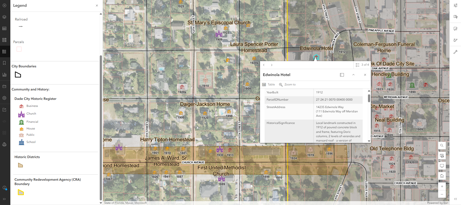
The interactive web map includes a geocoded point that Craig added for each historic entry, allowing visitors to read the full paragraph of historical significance written by the Historic Preservation Board for every property on the register.