
Zoning Maps
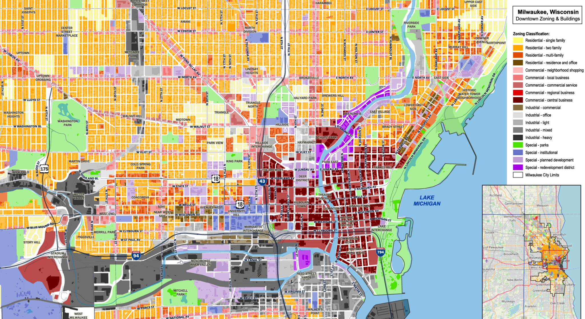
This zoning map shows the revitalization of the downtown and surrounding areas of Milwaukee, Wisconsin with a clear, readable overview of land use categories. Craig Spatial focused on strong color separation, disciplined hierarchy, and precise parcel level detail to make the map useful for planning and general public understanding. Data sources included municipal zoning layers, parcel data, street centerlines, and building footprints, all cleaned and standardized before styling.
To further complete the urban fabric, Craig manually drew American Family Field, home of the Brewers, Fiserv Forum, home of the Bucks, and the Summerfest main stage because these buildings were missing from the free OSM (OpenStreetMap) building extraction. The final layout emphasizes clarity at both the city and parcel scale. Additionally, the darker building tones stand out against the zoning palette with intentional typography and a balanced visual structure that works in print and digital formats.
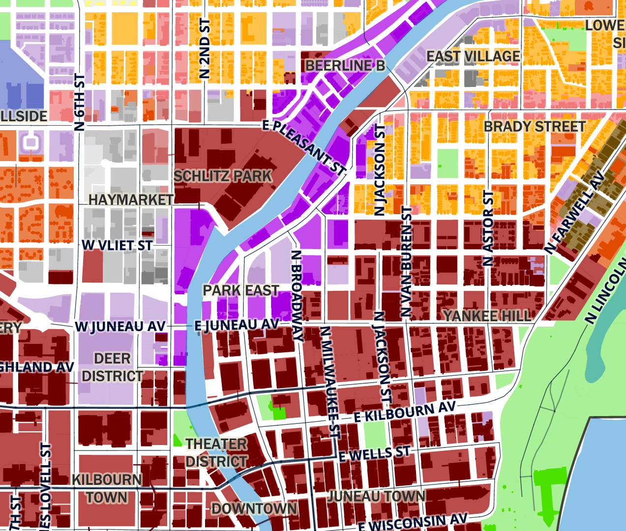
This detailed view shows the building footprints and zoning categories, paired with a cropped legend that highlights the bold color system—darker commercial red downtown, tan residential as the industry standard, lighter grey industrial areas for contrast, and a purple redevelopment district along the river. The map also reinforces clear street labeling, consistent building footprints, and a strong visual hierarchy.
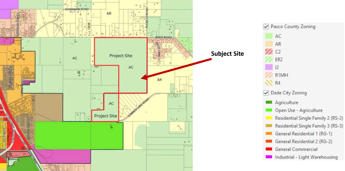
This map, prepared for a city commission meeting on a zoning and future land use amendment, uses a stronger, darker color scheme to emphasize the subject properties within Dade City, Florida limits, while applying a more muted palette for unincorporated Pasco County zoning. A supporting legend accompanies the map as part of the agenda packet.